
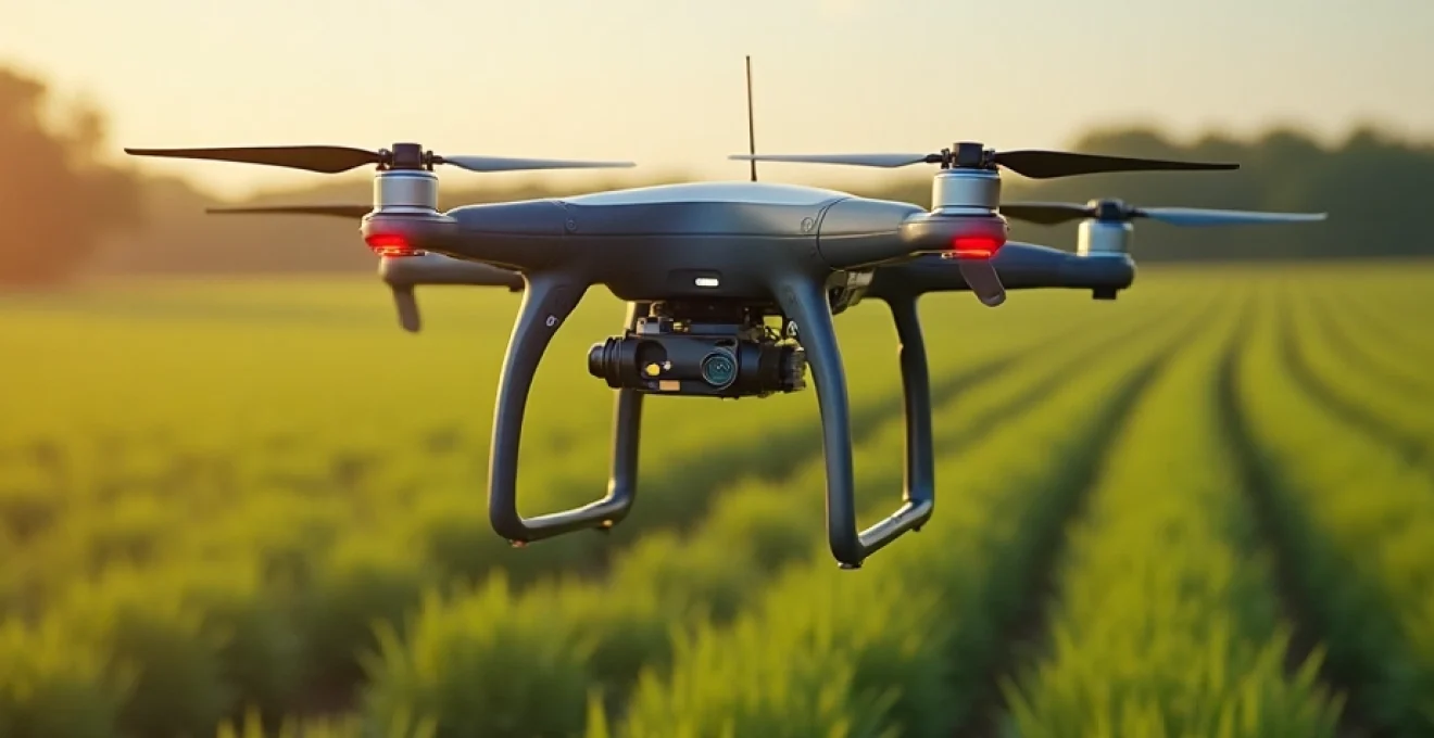
The agricultural landscape is rapidly evolving, with precision farming techniques revolutionizing how crops are monitored and managed. At the forefront of this transformation are farm drones equipped with advanced sensors and real-time data processing capabilities. These aerial marvels offer farmers unprecedented insights into crop health, soil conditions, and overall field performance. By leveraging cutting-edge technology, agriculturists can now make data-driven decisions that optimize yields, reduce resource waste, and ultimately increase profitability.
Agricultural drone technology and sensor integration
The power of farm drones lies in their ability to capture and process vast amounts of data quickly and efficiently. Modern agricultural drones are equipped with a diverse array of sensors, each designed to collect specific types of information about crops and field conditions. This integration of multiple sensing technologies provides farmers with a comprehensive view of their operations, enabling them to address issues proactively and fine-tune their farming practices.
Multispectral and hyperspectral imaging systems for crop health assessment
Multispectral and hyperspectral imaging systems are at the heart of crop health assessment via drone technology. These sophisticated sensors capture light reflectance across various wavelengths, including those beyond the visible spectrum. By analyzing the reflected light patterns, farmers can gain valuable insights into plant vigor, chlorophyll content, and overall crop health.
Multispectral sensors typically capture data in 4-10 distinct spectral bands, while hyperspectral sensors can collect information across hundreds of narrow bands. This level of detail allows for the detection of subtle changes in crop health, often before they become visible to the naked eye. For instance, a shift in near-infrared reflectance can indicate plant stress days or even weeks before physical symptoms appear, giving farmers a critical head start in addressing potential issues.
Lidar and RGB camera combinations for 3D crop modeling
The combination of LiDAR (Light Detection and Ranging) technology with traditional RGB cameras has opened up new possibilities for 3D crop modeling. LiDAR sensors emit laser pulses to measure distances with incredible precision, creating detailed point clouds that represent the physical structure of crops and terrain. When this data is overlaid with high-resolution RGB imagery, the result is a comprehensive 3D model of the entire field.
These 3D models offer several advantages for crop analysis:
- Accurate plant height measurements for growth tracking
- Canopy density assessment for yield estimation
- Precise terrain mapping for drainage and irrigation planning
- Volumetric calculations for biomass estimation
By utilizing LiDAR and RGB camera combinations , farmers can gain a deeper understanding of their crop’s physical characteristics and how they change over time. This information is invaluable for making informed decisions about crop management practices.
Thermal sensors for water stress detection and irrigation management
Thermal sensors on agricultural drones have become indispensable tools for water stress detection and irrigation management. These sensors measure the surface temperature of crops, providing crucial data on plant transpiration rates and water uptake. Since water-stressed plants tend to have higher surface temperatures, thermal imaging can quickly identify areas of the field that may require immediate attention.
The benefits of thermal sensing for irrigation management include:
- Early detection of water stress before visible symptoms appear
- Identification of irrigation system malfunctions or blockages
- Creation of precise irrigation maps for variable rate application
- Monitoring of crop water use efficiency
- Reduction of water waste and associated costs
By integrating thermal sensor data with other drone-collected information, farmers can develop highly efficient, targeted irrigation strategies that conserve water while optimizing crop health and yield potential.
Real-time data processing and analysis techniques
The true power of agricultural drones lies not just in their ability to collect data, but in the sophisticated processing and analysis techniques that transform raw information into actionable insights. Real-time data processing enables farmers to make quick, informed decisions based on the most current field conditions.
Edge computing solutions for On-Board image processing
Edge computing has emerged as a game-changer in agricultural drone technology, allowing for on-board image processing and immediate data analysis. By performing computations directly on the drone or at nearby edge devices, farmers can receive processed information in near real-time, without the need for constant connectivity to cloud services.
The advantages of edge computing for farm drones include:
- Reduced latency in data processing and decision-making
- Lower bandwidth requirements for data transmission
- Improved reliability in areas with poor network coverage
- Enhanced data privacy and security
With edge computing solutions, drones can perform complex tasks such as on-the-fly NDVI calculations or real-time crop stress detection , providing farmers with immediate insights as the drone surveys the field.
Machine learning algorithms for crop disease identification
Machine learning algorithms have revolutionized the way crop diseases are identified and managed. By training these algorithms on vast datasets of plant images, researchers have developed systems capable of recognizing the visual signatures of various crop diseases with remarkable accuracy.
When integrated with drone technology, these machine learning models can analyze multispectral and RGB imagery in real-time, flagging potential disease outbreaks for further investigation. This early warning system allows farmers to take swift action, potentially saving entire crops from devastating losses.
Machine learning-powered disease detection can identify crop health issues up to two weeks earlier than traditional scouting methods, significantly improving the chances of successful intervention.
The continuous improvement of these algorithms through federated learning techniques means that the accuracy and range of detectable diseases are constantly expanding, making farm drones increasingly valuable tools for crop protection.
Cloud-based platforms for Large-Scale data integration and visualization
While edge computing handles immediate processing needs, cloud-based platforms play a crucial role in large-scale data integration and visualization. These platforms aggregate data from multiple sources, including drones, ground sensors, and historical records, to provide a comprehensive view of farm operations.
Cloud platforms offer several key benefits for agricultural data management:
- Centralized storage and access to vast amounts of farm data
- Advanced analytics capabilities for trend analysis and forecasting
- Collaborative tools for sharing insights across farm management teams
- Scalable computing resources for handling peak processing demands
- Integration with other farm management systems and IoT devices
By leveraging cloud-based platforms, farmers can transform raw drone data into visually intuitive maps, charts, and reports that facilitate informed decision-making across all aspects of their operations.
Ai-powered predictive analytics for yield forecasting
Artificial intelligence (AI) and predictive analytics are taking yield forecasting to new levels of accuracy and granularity. By combining drone-collected data with historical yield information, weather patterns, and other relevant factors, AI models can generate highly precise yield predictions at various scales, from individual plants to entire fields.
These AI-powered forecasting systems offer several advantages:
- Early yield estimates for better supply chain and market planning
- Identification of underperforming areas for targeted interventions
- Optimization of harvest timing to maximize crop quality and yield
- Improved financial planning and risk management
As these predictive models continue to evolve and incorporate more data sources, including real-time drone imagery , their accuracy and reliability will only improve, making them indispensable tools for modern farm management.
Drone flight planning and autonomous navigation
Effective drone deployment in agriculture relies heavily on sophisticated flight planning and autonomous navigation systems. These technologies ensure that drones can cover large areas efficiently, collect consistent data, and operate safely in complex farm environments.
GPS-RTK systems for Centimeter-Level precision mapping
GPS-RTK (Real-Time Kinematic) technology has revolutionized the precision of drone-based mapping in agriculture. By using a network of ground-based reference stations, RTK systems can correct GPS signals in real-time, achieving centimeter-level accuracy in positioning.
This high level of precision is crucial for several agricultural applications:
- Creating highly accurate field boundary maps
- Generating precise elevation models for drainage planning
- Enabling repeatable flights for consistent time-series analysis
- Supporting precise variable rate applications of inputs
With GPS-RTK systems, farmers can rely on drone-generated maps for making critical decisions about field management, knowing that the data accurately represents the real-world conditions of their crops.
Obstacle avoidance technologies for safe Low-Altitude flights
Flying drones at low altitudes over agricultural fields presents unique challenges, including potential obstacles such as trees, power lines, and farm equipment. Advanced obstacle avoidance technologies are essential for ensuring safe and effective drone operations in these environments.
Modern farm drones employ a combination of sensors and algorithms to detect and avoid obstacles:
- Visual sensors for identifying and tracking objects
- Ultrasonic sensors for close-range detection
- LiDAR for creating 3D maps of the surrounding environment
- AI-powered path planning algorithms for real-time route adjustments
These technologies work together to create a virtual safety bubble around the drone, allowing it to navigate complex farm landscapes autonomously while maintaining the optimal flight path for data collection.
Mission planning software for optimized coverage and battery life
Efficient mission planning is critical for maximizing the effectiveness of farm drone operations. Specialized software tools allow farmers and drone operators to design flight plans that optimize coverage, ensure data quality, and manage battery life effectively.
Key features of advanced mission planning software include:
- Automated flight path generation based on field boundaries and desired resolution
- Multi-battery mission planning for covering large areas
- Integration with weather forecasts to schedule optimal flight times
- Customizable flight parameters for different crop types and growth stages
- Collision avoidance planning to ensure safe operations around known obstacles
By leveraging these sophisticated planning tools, farmers can ensure that their drone flights are as efficient and productive as possible, maximizing the return on investment in drone technology.
Integration with farm management systems
To fully realize the potential of drone technology in agriculture, seamless integration with existing farm management systems is essential. This integration allows for the efficient flow of data between various agricultural technologies, creating a cohesive and powerful decision-support ecosystem for farmers.
API protocols for seamless data exchange with FMIS platforms
Application Programming Interfaces (APIs) serve as the bridge between drone-collected data and Farm Management Information Systems (FMIS). Well-designed API protocols enable the smooth transfer of information, ensuring that valuable insights from drone flights are immediately available within the broader context of farm operations.
Key benefits of robust API integration include:
- Real-time data synchronization between drones and FMIS platforms
- Automated triggering of actions based on drone-detected conditions
- Streamlined workflow for data analysis and decision-making
- Enhanced interoperability between different agricultural technologies
By establishing standardized API protocols, the agricultural technology industry is fostering an environment of innovation and collaboration, ultimately benefiting farmers with more powerful and integrated tools.
Variable rate application maps generation from drone data
One of the most impactful applications of drone technology in precision agriculture is the generation of variable rate application (VRA) maps. These maps utilize the high-resolution, multispectral data collected by drones to create precise prescriptions for the application of inputs such as fertilizers, pesticides, and water.
The process of generating VRA maps from drone data typically involves:
- Collecting multispectral imagery of the field
- Processing the data to calculate vegetation indices (e.g., NDVI, NDRE)
- Analyzing the indices to identify zones of varying crop health or nutrient needs
- Creating prescription maps based on the identified zones
- Exporting the maps in formats compatible with variable rate application equipment
By using drone-generated VRA maps, farmers can apply inputs with unprecedented precision, optimizing resource use while maximizing crop yield and quality.
Blockchain technology for secure and transparent data sharing
As the volume and value of agricultural data continue to grow, ensuring the security and transparency of data sharing becomes increasingly important. Blockchain technology offers a promising solution for creating tamper-proof records of drone-collected data and facilitating secure data exchange between stakeholders in the agricultural supply chain.
The application of blockchain in agricultural drone data management provides several advantages:
- Immutable record-keeping of drone flight data and collected imagery
- Secure sharing of crop health and yield data with insurers, buyers, and regulators
- Transparent tracking of farm inputs and practices for certification purposes
- Creation of data marketplaces where farmers can monetize their agronomic data
By leveraging blockchain technology, the agricultural industry can build trust and efficiency into data-sharing processes, opening up new opportunities for collaboration and value creation.
Regulatory compliance and best practices
As the use of drones in agriculture becomes more widespread, understanding and adhering to regulatory requirements and industry best practices is crucial for safe and legal operations. Farmers and drone operators must navigate a complex landscape of regulations while also considering the ethical implications of their technology use.
FAA part 107 certification requirements for agricultural drone pilots
In the United States, the Federal Aviation Administration (FAA) regulates the commercial use of drones through its Part 107 rules. Agricultural drone pilots must obtain a Remote Pilot Certificate, which involves passing an aeronautical knowledge test and undergoing a background check.
Key requirements under Part 107 include:
- Flying drones weighing less than 55 pounds
- Maintaining visual line of sight with the drone at all times
- Flying only during daylight hours or civil twilight
- Keeping the drone below 400 feet above ground level
- Yielding right of way to manned aircraft
Farmers should ensure that their drone operators are fully certified and familiar with all applicable regulations to maintain compliance and ensure safe operations.
Data privacy and security measures for farm drone operations
The collection and storage of high-resolution imagery and other sensitive farm data raise important privacy and security concerns. Implementing robust data protection measures is essential for maintaining the trust of stakeholders and protecting valuable intellectual property.
Best practices for data privacy and security in farm drone operations include:
- Encrypting all data transmissions and storage
- Implementing strict access controls for drone-collected data
- Regularly updating drone firmware and software to address security vulnerabilities
- Developing clear data ownership and usage policies
- Training staff on data handling procedures and cybersecurity best practices
By prioritizing data privacy and security, farmers can harness the full potential of drone technology while mitigating risks associated with data breaches or unauthorized access.
Environmental impact assessments of Drone-Based crop monitoring
While drones offer significant benefits for agricultural efficiency, it’s important to consider their potential environmental impacts. Conducting thorough environmental impact assessments can help identify an
d mitigate potential negative effects. This assessment should consider factors such as:
- Noise pollution and its impact on wildlife
- Energy consumption and carbon footprint of drone operations
- Potential disturbance to local ecosystems during low-altitude flights
- Chemical runoff from increased precision in pesticide application
- Long-term effects on soil compaction from reduced tractor use
By conducting thorough environmental impact assessments, farmers can develop strategies to minimize any adverse effects of drone technology while maximizing its benefits for sustainable agriculture. This may include implementing noise reduction technologies, optimizing flight paths to avoid sensitive areas, and using renewable energy sources for drone charging.
Moreover, the data collected by drones can itself contribute to environmental conservation efforts. High-resolution imagery and detailed crop health information can help farmers reduce overall pesticide and fertilizer use, leading to improved water quality and reduced chemical runoff. Additionally, precise irrigation management enabled by drone technology can significantly reduce water waste, contributing to water conservation efforts in agriculture.
As drone technology continues to evolve, it’s crucial for the agricultural industry to maintain a proactive approach to environmental stewardship. By balancing the benefits of increased productivity with responsible environmental practices, farmers can leverage drone-based crop monitoring to not only improve their yields but also enhance the overall sustainability of their operations.