
The agricultural landscape is undergoing a technological revolution, with GPS-enabled tractors at the forefront of this transformation. These advanced machines are reshaping farming practices, offering unprecedented levels of precision and efficiency. By harnessing the power of satellite navigation, modern tractors are not just tools for tilling soil; they’ve become sophisticated platforms for data-driven agriculture, capable of optimizing every aspect of crop production.
GPS tractors represent a significant leap forward in farming technology, addressing long-standing challenges in agriculture such as resource management, labor shortages, and environmental concerns. With their ability to navigate fields with centimeter-level accuracy, these smart machines are enabling farmers to maximize yields while minimizing inputs, leading to more sustainable and profitable farming operations.
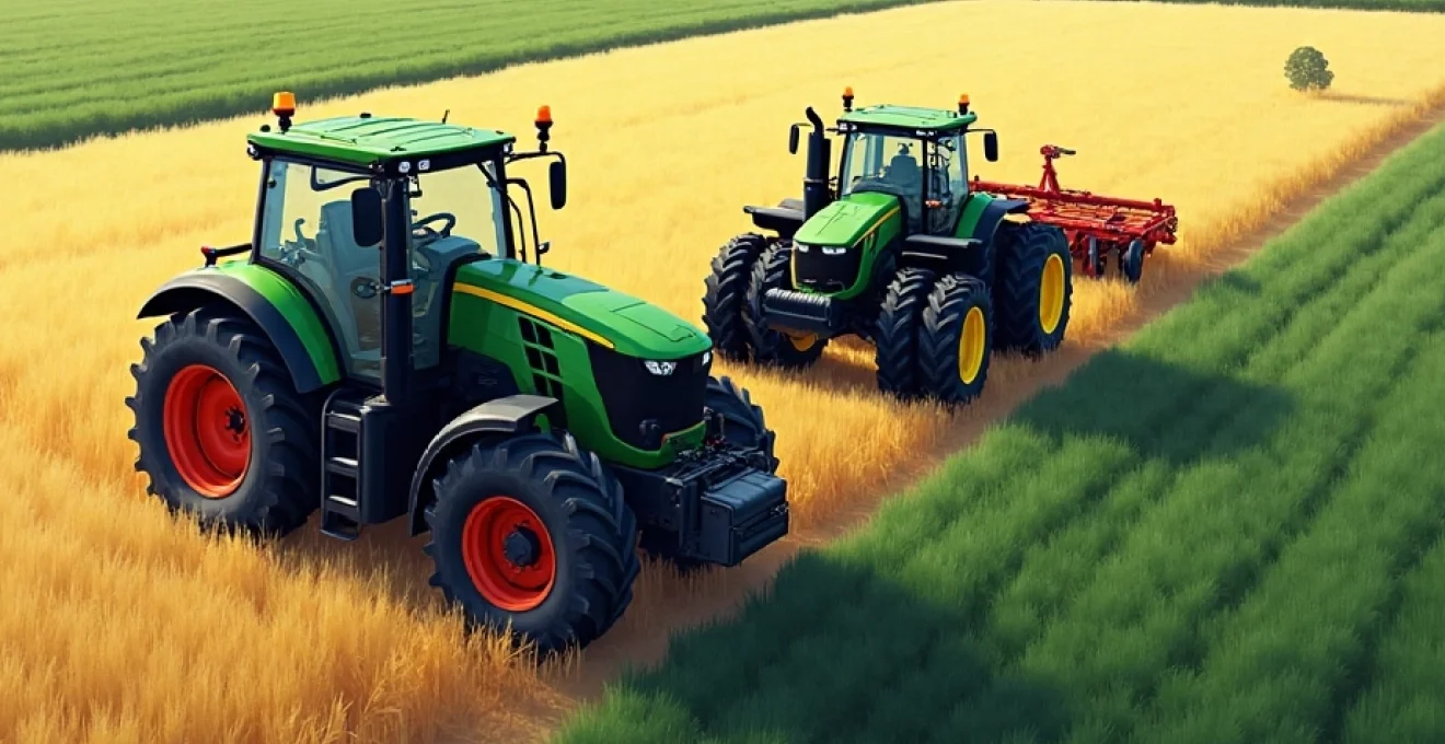
Gps-guided auto-steering systems in modern tractors
At the heart of GPS tractor technology lies the auto-steering system, a game-changing feature that has revolutionized field operations. These systems use satellite positioning to guide tractors along precise paths, eliminating the need for manual steering and reducing driver fatigue. Auto-steering ensures consistent spacing between rows, minimizes overlap or gaps in field coverage, and allows for operation in low-visibility conditions such as dust, fog, or darkness.
The benefits of GPS-guided auto-steering are manifold. Farmers can achieve higher levels of accuracy in planting, spraying, and harvesting, leading to more efficient use of seeds, fertilizers, and pesticides. This precision not only reduces input costs but also minimizes environmental impact by preventing over-application of chemicals. Additionally, auto-steering systems enable longer working hours and reduce operator stress, contributing to increased productivity.
Modern auto-steering systems are highly sophisticated, capable of adapting to various field shapes and terrains. They can memorize field boundaries and obstacles, allowing for automated turns at the end of rows and seamless navigation around known objects. Some advanced systems even incorporate obstacle detection sensors for added safety and efficiency.
Real-time kinematic (RTK) positioning for centimeter-level accuracy
While standard GPS can provide accuracy within a few meters, precision agriculture demands much higher levels of precision. This is where Real-Time Kinematic (RTK) positioning comes into play, offering centimeter-level accuracy that is crucial for many farming applications. RTK technology enhances the basic GPS signal by comparing it with a known fixed position, typically provided by a base station.
Base station and rover setup for RTK correction signals
The RTK system consists of two main components: a base station and a rover. The base station is a fixed GPS receiver set up at a known location, often on the farm property. It continuously monitors the GPS signals and calculates the difference between its known position and the position indicated by the GPS signals. This difference, or correction data, is then transmitted to the rover – in this case, the GPS-equipped tractor.
The rover receives both the standard GPS signals and the correction data from the base station. By combining these two sets of information, the tractor’s GPS system can achieve incredibly precise positioning. This level of accuracy is essential for applications such as controlled traffic farming , where vehicles follow the same wheel tracks year after year to minimize soil compaction.
GNSS constellations utilized: GPS, GLONASS, galileo, and BeiDou
Modern RTK systems don’t rely solely on the American GPS constellation. They utilize multiple Global Navigation Satellite Systems (GNSS), including Russia’s GLONASS, the European Union’s Galileo, and China’s BeiDou. By tapping into these additional satellite networks, RTK-enabled tractors can maintain high accuracy even in challenging conditions where the view of the sky might be partially obstructed.
The use of multiple GNSS constellations also improves the system’s reliability and availability. With more satellites in view, the tractor’s positioning system can maintain accuracy even if signals from one constellation are temporarily unavailable or degraded. This multi-constellation approach is particularly beneficial in areas with hilly terrain or dense vegetation that might interfere with satellite signals.
Implementing RTK networks for large-scale precision agriculture
For large-scale farming operations, implementing a network of RTK base stations can provide seamless coverage across vast areas. These networks, often referred to as Continuously Operating Reference Stations (CORS), consist of multiple fixed base stations strategically placed to cover entire regions. Farmers can subscribe to these networks, eliminating the need to set up and maintain their own base stations.
RTK networks offer several advantages for large-scale precision agriculture. They provide consistent accuracy across wide areas, enable smooth transitions between fields, and reduce the initial investment and ongoing maintenance costs associated with individual base stations. Some advanced networks even offer virtual reference station (VRS) technology, which interpolates correction data for the precise location of each rover, further enhancing accuracy and reliability.
Overcoming signal obstructions in challenging terrains
While RTK technology significantly improves positioning accuracy, challenges can arise in areas with signal obstructions such as dense forests, steep valleys, or tall structures. To address these issues, manufacturers have developed innovative solutions to maintain accuracy in difficult conditions.
One such solution is the use of inertial measurement units (IMUs) in combination with GNSS receivers. IMUs use accelerometers and gyroscopes to track the tractor’s movement when satellite signals are temporarily lost. This sensor fusion approach allows the tractor to maintain accurate positioning even when passing under tree canopies or through other areas with poor satellite visibility.
Another strategy involves the use of augmentation systems such as Satellite-Based Augmentation Systems (SBAS) or ground-based augmentation systems. These systems provide additional correction data to improve accuracy and reliability in areas where RTK signals might be compromised.
Variable rate technology (VRT) integration with GPS tractors
The marriage of GPS technology with Variable Rate Technology (VRT) represents a significant leap forward in precision agriculture. VRT allows farmers to adjust the application rates of inputs such as seeds, fertilizers, and pesticides based on the specific needs of different areas within a field. When integrated with GPS-guided tractors, VRT systems can automatically vary application rates as the tractor moves across the field, optimizing resource use and crop yields.
Precision application of fertilizers using GPS-guided VRT systems
Fertilizer application is one area where VRT shines. By combining GPS positioning with soil fertility maps and crop health data, VRT systems can apply fertilizers at varying rates across a field. This precision approach ensures that each area receives the optimal amount of nutrients, avoiding over-application in fertile zones and under-application in areas of higher need.
The benefits of precision fertilizer application are substantial. It reduces waste, lowers input costs, and minimizes the environmental impact of excess nutrients leaching into water systems. Moreover, by providing each plant with the ideal nutrient balance, farmers can achieve more uniform crop growth and potentially higher yields.
Site-specific seeding rates based on soil fertility maps
VRT systems also revolutionize the planting process by enabling variable seeding rates. Using GPS-guided tractors equipped with VRT planters, farmers can adjust seed density based on soil fertility, moisture levels, and other factors that influence crop growth potential. In areas with high fertility and good moisture retention, seeds can be planted at higher densities to maximize yield potential. Conversely, in less favorable areas, lower seeding rates can be used to avoid wasting seeds and reduce competition for limited resources.
This site-specific approach to seeding optimizes plant populations across the field, leading to more efficient use of resources and potentially higher overall yields. It also helps in managing variability within fields, ensuring that each area is planted at its optimal density for the best possible outcome.
Automated sprayer control for targeted pest management
GPS-guided VRT systems have transformed pest management practices by enabling precise and targeted application of pesticides. Automated sprayer control systems use GPS positioning along with pre-mapped information about pest pressure or crop health to adjust spray rates on-the-go. This technology can even turn off individual nozzles when passing over areas that don’t require treatment, such as waterways or areas with low pest pressure.
The advantages of this approach are numerous. It reduces overall pesticide use, minimizes drift, and decreases the environmental impact of crop protection activities. Additionally, by ensuring that each area receives the appropriate amount of treatment, farmers can improve the effectiveness of their pest management strategies while potentially lowering costs.
Data logging and analysis for continuous improvement
One of the most valuable aspects of GPS-enabled VRT systems is their ability to log detailed data about every operation. As tractors move across fields, they record information such as application rates, yields, and soil conditions. This wealth of data can be analyzed to gain insights into field variability, crop performance, and the effectiveness of different management strategies.
By leveraging this data, farmers can make informed decisions about future operations, refine their management practices, and continuously improve their farming efficiency. The combination of GPS positioning, VRT, and data analytics creates a powerful feedback loop that drives ongoing optimization of farm operations.
Machine-to-machine communication in GPS-enabled farm equipment
The integration of GPS technology in farm equipment has paved the way for advanced machine-to-machine (M2M) communication, ushering in a new era of coordinated and efficient farming operations. This interconnectedness allows multiple pieces of equipment to work together seamlessly, sharing data and coordinating actions in real-time.
For example, during harvest, a combine equipped with GPS and yield monitoring technology can communicate with grain carts, directing them to the optimal position for unloading. This coordination minimizes downtime and ensures efficient use of all equipment. Similarly, tractors pulling planters can communicate with fertilizer applicators, ensuring that seed and fertilizer placement are perfectly synchronized.
M2M communication also enables fleet management on a larger scale. Farm managers can monitor the location and status of all equipment in real-time, optimizing logistics and resource allocation across the entire operation. This level of coordination and oversight was simply not possible before the advent of GPS-enabled farm equipment.
Telematics and remote diagnostics in GPS tractors
Modern GPS tractors are equipped with sophisticated telematics systems that go beyond simple positioning. These systems collect and transmit a wide range of data about the tractor’s performance, including engine hours, fuel consumption, maintenance needs, and operational efficiency. This information is typically accessible through web portals or mobile apps, allowing farmers and equipment managers to monitor their fleet from anywhere.
Remote diagnostics capabilities take this a step further. When a problem occurs, technicians can access the tractor’s systems remotely, often diagnosing issues without the need for an on-site visit. This can significantly reduce downtime and maintenance costs. In some cases, software updates or minor adjustments can even be made remotely, keeping equipment in peak operating condition with minimal disruption to farm operations.
Telematics and remote diagnostics also play a crucial role in preventive maintenance. By analyzing patterns in the data, potential issues can be identified and addressed before they lead to breakdowns. This proactive approach to equipment management helps ensure maximum uptime during critical farming windows.
Economic impact of GPS tractor technology on farm operations
The adoption of GPS tractor technology has had a profound economic impact on farm operations. While the initial investment in GPS-enabled equipment can be significant, the long-term benefits often outweigh the costs, particularly for medium to large-scale operations.
Reduction in input costs through precision application
One of the most immediate economic benefits of GPS tractor technology is the reduction in input costs. Precision application of seeds, fertilizers, and pesticides can lead to significant savings. Studies have shown that farmers using GPS-guided equipment with VRT can reduce their input costs by 10-15% on average, with some reporting savings of up to 20-30% in certain operations.
These savings are achieved through several mechanisms:
- Elimination of overlaps and skips in field operations
- Targeted application of inputs based on field variability
- Reduced waste of expensive materials like seeds and chemicals
- Lower fuel consumption due to optimized field paths
- Decreased wear and tear on equipment from more efficient operation
Labor efficiency gains and operational scalability
GPS tractor technology significantly enhances labor efficiency. Auto-steering systems reduce operator fatigue, allowing for longer working hours when necessary. This can be particularly valuable during critical planting or harvesting windows. Additionally, the precision and automation provided by GPS systems enable less experienced operators to perform complex tasks with high accuracy, addressing some of the challenges posed by labor shortages in agriculture.
The increased efficiency also allows farms to scale their operations more effectively. With GPS-guided equipment, a single operator can manage larger areas with greater precision than was previously possible. This scalability can lead to economies of scale, improving the overall profitability of farm operations.
Yield improvements attributed to GPS-guided farming practices
While the reduction in input costs is significant, the potential for yield improvements often represents an even greater economic benefit. By optimizing every aspect of crop production – from precise seed placement to targeted nutrient application – GPS-guided farming practices can lead to substantial increases in crop yields.
The extent of yield improvements can vary depending on factors such as crop type, field conditions, and the specific technologies employed. However, many farmers report yield increases of 3-10% after implementing GPS-guided precision farming techniques. In some cases, particularly in fields with high variability, yield improvements of 15% or more have been observed.
Return on investment analysis for GPS tractor upgrades
When considering the adoption of GPS tractor technology, a thorough return on investment (ROI) analysis is crucial. The ROI can vary significantly depending on factors such as farm size, crop types, and existing equipment. However, many farmers find that the investment pays off within 2-3 years, with some reporting even faster returns.
A typical ROI calculation might consider the following factors:
- Initial equipment costs (GPS receivers, auto-steering systems, VRT equipment)
- Ongoing subscription fees for RTK networks or other services
- Projected savings on inputs (seeds, fertilizers, pesticides)
- Estimated yield increases and their value
- Labor cost savings or increased operational capacity
- Potential reduction in equipment wear and fuel consumption
It’s important to note that while the financial benefits are often substantial, many farmers also value the non-monetary benefits of GPS tractor technology. These can include reduced stress, improved work-life balance due to more efficient operations, and the satisfaction of knowing they are farming more sustainably.
As GPS tractor technology continues to evolve, its impact on farming efficiency is likely to grow even further. From autonomous vehicles to AI-driven decision support systems, the future of agriculture is increasingly intertwined with advanced positioning and data analytics technologies. For farmers looking to stay competitive in a challenging global market, embracing these innovations may be not just beneficial, but essential.