
Precision farming tools are transforming the agricultural landscape, ushering in a new era of efficiency, sustainability, and productivity. These advanced technologies leverage data-driven insights to optimize every aspect of crop management, from planting to harvest. By harnessing the power of GPS, remote sensing, and artificial intelligence, farmers can now make informed decisions that maximize yields while minimizing resource use. This revolution in agriculture is not just about increasing profits; it’s about creating a more sustainable and resilient food production system capable of meeting the demands of a growing global population.
Precision agriculture technologies transforming crop management
The adoption of precision agriculture technologies has become a game-changer for modern farmers. These tools provide unprecedented levels of accuracy and control over farming operations, enabling growers to fine-tune their practices for optimal results. From variable rate application of inputs to real-time crop monitoring, precision agriculture is reshaping how we approach food production.
One of the most significant advantages of precision agriculture is its ability to address field variability. Traditional farming methods often treat entire fields uniformly, leading to inefficiencies and waste. In contrast, precision farming tools allow for site-specific management, taking into account the unique characteristics of different areas within a field. This targeted approach not only improves crop yields but also reduces environmental impact by minimizing the overuse of water, fertilizers, and pesticides.
Moreover, precision agriculture technologies are helping farmers become more proactive in their decision-making. By providing real-time data on crop health, soil conditions, and weather patterns, these tools enable growers to anticipate and address potential issues before they become serious problems. This shift from reactive to proactive management is revolutionizing the way farms operate, leading to more stable and predictable yields.
Gps-guided machinery and variable rate application
At the heart of precision agriculture lies GPS-guided machinery and variable rate application technology. These innovations have dramatically improved the accuracy and efficiency of farming operations, from planting to harvesting. By utilizing satellite positioning systems, farmers can navigate their fields with centimeter-level precision, reducing overlap and ensuring complete coverage.
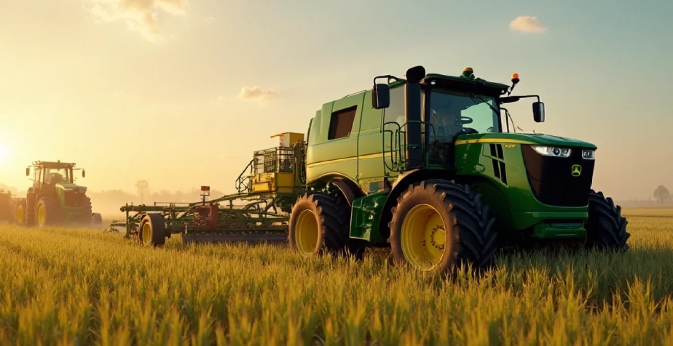
John deere AutoTrac™ system for automated steering
The John Deere AutoTrac™ system is a prime example of how GPS-guided machinery is revolutionizing agriculture. This automated steering system allows tractors and other equipment to follow precise paths across fields, minimizing errors and reducing operator fatigue. With AutoTrac™, farmers can achieve consistent row spacing and reduce skips and overlaps, leading to improved seed placement, more efficient use of inputs, and ultimately, higher yields.
Trimble’s Field-IQ™ crop input control system
Trimble’s Field-IQ™ Crop Input Control System takes variable rate application to the next level. This advanced system allows for precise control over the application of seeds, fertilizers, and crop protection products. By integrating with GPS technology and field maps, Field-IQ™ can automatically adjust application rates based on specific zones within a field, ensuring that each area receives the optimal amount of inputs.
Agco’s VarioGuide for precision planting
AGCO’s VarioGuide system is another innovative solution for precision planting. This technology uses advanced GPS guidance to ensure accurate seed placement, even in challenging field conditions. VarioGuide allows farmers to create and follow precise AB lines, contours, and pivots, resulting in perfectly straight rows and optimized plant spacing. This level of accuracy not only improves crop emergence but also facilitates easier management throughout the growing season.
Case IH AFS AccuGuide™ for Real-Time kinematics (RTK)
The Case IH AFS AccuGuide™ system utilizes Real-Time Kinematics (RTK) technology to provide sub-inch accuracy in field operations. RTK enhances the precision of GPS guidance by using fixed base stations to correct for atmospheric interference and other factors that can affect satellite signals. This ultra-precise guidance enables farmers to implement advanced farming techniques such as strip-till and controlled traffic farming, which can significantly reduce soil compaction and improve overall field health.
Remote sensing and satellite imagery in field monitoring
Remote sensing and satellite imagery have emerged as powerful tools for field monitoring and crop management. These technologies provide farmers with a bird’s-eye view of their fields, offering insights that would be impossible to obtain from ground level. By analyzing multispectral images, growers can assess crop health, detect pest infestations, and identify areas of stress long before they become visible to the naked eye.
Sentinel-2 multispectral imaging for crop health assessment
The Sentinel-2 satellite constellation, operated by the European Space Agency, has become an invaluable resource for precision agriculture. Its multispectral imaging capabilities allow for the creation of detailed vegetation indices, such as the Normalized Difference Vegetation Index (NDVI). These indices provide a quantitative measure of crop health and vigor, enabling farmers to identify problem areas quickly and take corrective action.
Planetscope’s daily earth imaging for precision agriculture
PlanetScope’s constellation of small satellites offers daily imaging of the Earth’s surface, providing unprecedented temporal resolution for agricultural monitoring. This high-frequency imaging allows farmers to track changes in their fields on a day-to-day basis, making it possible to detect and respond to issues such as pest outbreaks or irrigation problems almost immediately. The ability to monitor crops with such regularity is transforming how farmers manage risk and make decisions throughout the growing season.
Drone-based NDVI mapping with DJI P4 multispectral
While satellite imagery provides broad coverage, drone-based NDVI mapping offers a more detailed view of crop health at the field level. The DJI P4 Multispectral drone is specifically designed for agricultural applications, equipped with a multispectral imaging system that captures both visible and near-infrared light. This technology allows for the creation of high-resolution NDVI maps that can reveal subtle variations in crop health, enabling targeted interventions and more efficient resource allocation.
Lidar technology for 3D field mapping and drainage planning
LiDAR (Light Detection and Ranging) technology is revolutionizing field mapping and drainage planning in agriculture. By using laser pulses to measure distances and create detailed 3D models of the landscape, LiDAR provides farmers with accurate topographical information. This data is invaluable for optimizing drainage systems, planning irrigation infrastructure, and identifying areas prone to erosion or water pooling. The precision of LiDAR mapping enables farmers to make informed decisions about land management that can significantly improve field productivity and sustainability.
Iot sensors and data analytics platforms
The Internet of Things (IoT) has brought a new level of connectivity and data collection to agriculture. IoT sensors deployed across fields can continuously monitor a wide range of parameters, from soil moisture and temperature to air quality and plant stress levels. This constant stream of data, when combined with powerful analytics platforms, provides farmers with unprecedented insights into their operations.
John deere operations center for farm data management
The John Deere Operations Center is a comprehensive farm management platform that integrates data from various sources, including machinery, sensors, and satellite imagery. This cloud-based system allows farmers to view real-time information about their operations, analyze historical data, and make informed decisions about planting, fertilization, and harvesting. By centralizing data management, the Operations Center enables farmers to optimize their workflows and improve overall farm efficiency.
Sentera’s FieldAgent® for Real-Time crop intelligence
Sentera’s FieldAgent® platform combines drone-based imagery with advanced analytics to provide real-time crop intelligence. This system can detect early signs of crop stress, disease, or nutrient deficiencies, allowing for timely interventions. FieldAgent® also offers tools for creating prescription maps for variable rate applications, ensuring that inputs are applied precisely where they are needed most. This level of precision not only improves crop yields but also reduces waste and environmental impact.
Cropx soil monitoring system for irrigation optimization
The CropX soil monitoring system uses advanced sensors and cloud-based analytics to optimize irrigation practices. By providing accurate, real-time data on soil moisture levels at various depths, CropX enables farmers to make informed decisions about when and how much to irrigate. This precision approach to water management can lead to significant water savings while improving crop yields and quality. The system’s ability to integrate with existing irrigation equipment makes it a powerful tool for enhancing water use efficiency in agriculture.
Farmers edge smart VR™ for variable rate prescriptions
Farmers Edge Smart VR™ technology takes variable rate application to new heights by integrating multiple data sources to create highly accurate prescription maps. This system combines soil testing results, historical yield data, satellite imagery, and weather information to determine the optimal application rates for seeds, fertilizers, and other inputs across different zones within a field. By tailoring input applications to the specific needs of each area, Smart VR™ helps farmers maximize their return on investment while minimizing environmental impact.
AI and machine learning in crop yield prediction
Artificial Intelligence (AI) and Machine Learning (ML) are rapidly becoming indispensable tools in precision agriculture, particularly in the realm of crop yield prediction. These advanced technologies can analyze vast amounts of data from various sources, including historical yield records, weather patterns, soil conditions, and satellite imagery, to provide accurate forecasts of crop performance.
AI-powered yield prediction models can take into account a multitude of variables that influence crop growth, such as temperature fluctuations, precipitation levels, and even potential pest pressures. By processing this complex web of information, these models can generate highly accurate yield estimates weeks or even months before harvest. This predictive capability allows farmers to make more informed decisions about resource allocation, marketing strategies, and risk management.
Moreover, as these AI systems continue to learn and improve over time, their predictions become increasingly accurate and reliable. This ongoing refinement is particularly valuable in the face of changing climate patterns and evolving agricultural practices. Farmers can use these AI-driven insights to adapt their strategies proactively, ensuring resilience in the face of uncertainty.
The integration of AI and Machine Learning in agriculture is not just about prediction; it’s about empowering farmers with the knowledge to make better decisions at every stage of the growing season.
One of the most exciting aspects of AI in crop yield prediction is its ability to provide site-specific forecasts. Rather than relying on broad regional estimates, farmers can now access predictions tailored to their specific fields, taking into account local microclimates and soil variations. This level of granularity enables more precise planning and resource allocation, ultimately leading to improved yields and reduced waste.
Blockchain technology for agricultural supply chain traceability
Blockchain technology is emerging as a powerful tool for enhancing transparency and traceability in agricultural supply chains. This distributed ledger system creates an immutable record of transactions and data points throughout the production and distribution process, from farm to table. The implementation of blockchain in agriculture has far-reaching implications for food safety, quality assurance, and consumer trust.
One of the primary benefits of blockchain in agriculture is its ability to provide complete traceability of food products. In the event of a food safety issue or recall, blockchain enables rapid and precise identification of the source of contamination, potentially saving lives and minimizing economic losses. This level of traceability also helps combat fraud and counterfeiting in the food industry, ensuring that consumers receive authentic, high-quality products.
For farmers, blockchain technology offers new opportunities to showcase the quality and provenance of their products. By recording key data points throughout the growing process, such as planting dates, input applications, and harvest conditions, farmers can provide consumers with a comprehensive history of their food. This transparency can be particularly valuable for specialty crops, organic produce, and other premium products where authenticity and production methods are key selling points.
Blockchain also has the potential to streamline agricultural supply chains by reducing paperwork and administrative overhead. Smart contracts, which are self-executing contracts with the terms of the agreement directly written into code, can automate many aspects of transactions between farmers, distributors, and retailers. This automation not only reduces errors and disputes but also accelerates payment processes, improving cash flow for farmers.
Blockchain technology in agriculture is not just about recording transactions; it’s about creating a new level of trust and efficiency throughout the entire food system.
As blockchain adoption in agriculture continues to grow, we can expect to see new innovations that leverage this technology. For example, blockchain could be used to create more efficient and transparent carbon credit systems for sustainable farming practices, or to develop new models for crop insurance based on verifiable, real-time data. The potential applications are vast, and they all point towards a more connected, transparent, and resilient agricultural sector.
The revolution in precision farming tools is fundamentally changing the face of agriculture. From GPS-guided machinery and remote sensing to AI-powered analytics and blockchain traceability, these technologies are empowering farmers to produce more food with fewer resources while minimizing environmental impact. As these tools continue to evolve and become more accessible, they promise to create a more sustainable, efficient, and productive agricultural system capable of meeting the challenges of the 21st century and beyond.